In Lab 4, the goal was to become familiar with the software Pix4D. To do this, volumes were calculated, animations were created, and maps were made with the results. Discussion of the software and its features were included as well. That information can be accessed here. For lab 5, data will be processed using Ground Control Points (GCPs) in Pix4D. A GCP is a characteristic point in a known coordinate system and traditional surveying methods are used to measure those coordinates. The GCP data was provided for this lab by the University of Wisconsin-Eau Claire. The objective of this lab was to process real life data using GCPs and create a shapefile to create a map in ArcGis. Lastly, the area of study for this lab is a garden plot located in the Eau Claire Priory.
Methods:
To start off, a New Project was opened in Pix4D and the 69 images provided for this lab were added. After all of the images are added, the shutter model needed to be Edited and changed from Global Shutter to Linear Rolling Shuttle. Next, the GCPs were imported into the project with the GCP/MTP Manager in the X,Y, Z format. The overall layout of the flight was then shown in mapview after clicking Finish in the window. Then, steps 2 and 3 were unchecked right away on the bottom of the screen so then the only box that was checked was Initial Processing. Finally, the Start button could be clicked to begin the processing which took quite a bit of time. When the processing is done, it will produce a quality report. This report is important to look over because it provides information on the accuracy and the RMS error of the 9 ground control points (Figure 1).
 |
| Figure 1: Quality Report of the Ground Control Points |
It the quality report looks good, the processing can be complete and all the steps will be green once everything is finished. Going into RayCloud view will show the outcome of the data. Turning off the cameras and turning on the triangle mesh will show model of the data (Figure 2).
 |
Results:
The first map (Figure 3) shows the orthomosaic product from Pix4D and includes an image from ArcScene and a locater map of Eau Claire. Information about the projection, pixel resolution, and sensor are located at the bottom of the map.
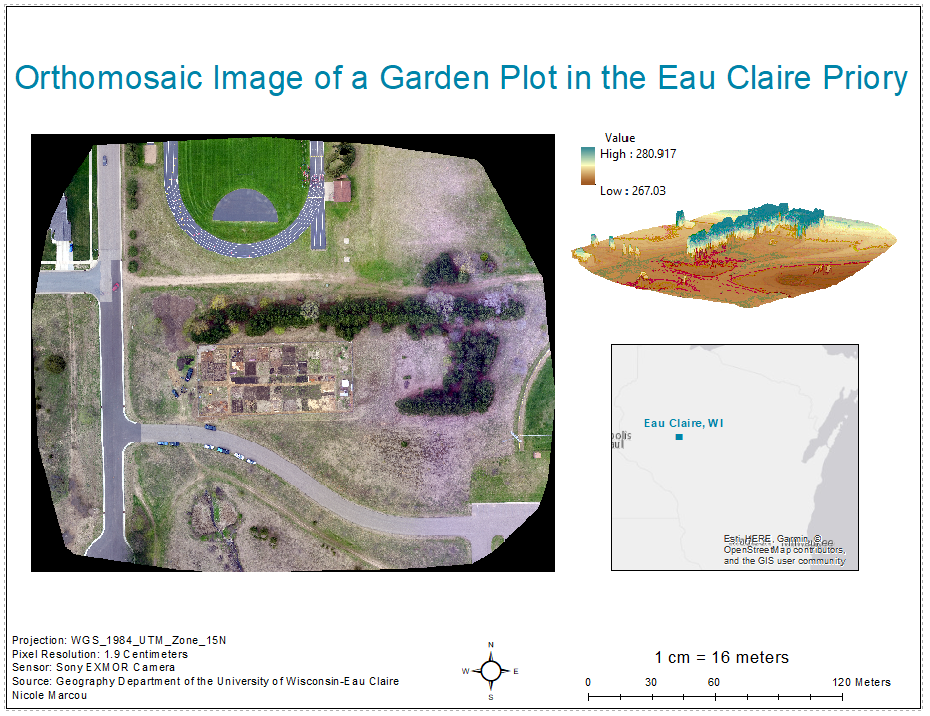 |
| Figure 3: Orthomosaic Image of a Garden Plot in the Eau Claire Priory |
 |
| Figure 4: DSM of a Garden Plot in the Eau Claire Priory |
Processing data using GCPs in Pix4D was a long process but it created a great result. The hands on effect of calibrating each GCP to ensure accuracy was helpful experience. Analyzing the quality report was difficult because of the length and detail but the necessary information was gathered. The elevation of this specific plot was relatively minimal so it would be very interesting to process data that had great variance in elevation levels. This lab demonstrated important information in processing UAS data.
Sources:
https://support.pix4d.com/hc/en-us/articles/115002441583-Ground-control-points-GCPs-
No comments:
Post a Comment